20 SUMNER RD
Owner Information
GERMANOS RAMZI N
20 SUMNER RD
BROOKLINE, MA 02445


Property Details
20 SUMNER RD is classified as a Single Family Residential (Ranch).
The primary structure on this property was built in 1950. There is 2453ft2 of residential/living space within this property. This property is listed as having 9 rooms.
20 SUMNER RD is valued at 1265900. The land is valued at 869500 and the structures are valued at 396400.
This property is in Zone S10. Confirm with local Zoning Board authorities to ensure there are no overlays or other easements on this property.
The most recent deed for 20 SUMNER RD is recorded at the local registrar in Book 9751, Page 427. 20 SUMNER RD was last sold on 1993-02-22 for 319000.
Assessment data from fiscal year 2021.
Flood Data
According to the FEMA National Flood Hazard Layer, this property does not appear to be in a flood zone. It may also be in an area not yet reviewed. Nonetheless, confirm this information prior to taking any action.
To view the flood hazards around this property, create a FEMA "Firmette" Map of the area around 20 SUMNER RD.
Broadband Internet Providers
| Provider | Type | Bandwidth (mbps) | |
|---|---|---|---|
| RCN | Cable | 500 | 20 |
| Verizon New England Inc. | DSL | 10 | 1 |
| Starry, Inc. | Fixed Wireless | 200 | 200 |
| RCN | Cable | 1000 | 20 |
| Comcast | Cable | 1000 | 35 |
| Crown Castle Fiber | Fiber | 0 | 0 |
| Viasat Inc | Satellite | 100 | 3 |
| GCI Communication Corp. | Satellite | 0 | 0 |
| HughesNet | Satellite | 25 | 3 |
| VSAT Systems, LLC. | Satellite | 2 | 1 |
Broadband service provider data from December 2020.
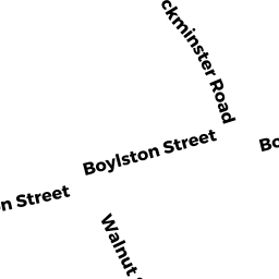
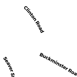
Adjacent Properties
- 14 SUMNER RD
Single Family Residential owned by ANDRA VENKAJI & VIJAYALAKSHMI - 42 BUCKMINSTER RD
Single Family Residential owned by SILOBRCIC JOSKO - 54 BUCKMINSTER RD
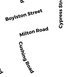
Single Family Residential owned by BEN-AKIVA, TR MOSHE E - 545 BOYLSTON ST 545
Residential Condominium owned by ROGERS TRS KATHLEEN A - 17 CATLIN RD 17
Residential Condominium owned by OSTER GERRY - 511 BOYLSTON ST 511
Residential Condominium owned by SENGUPTA PUSHAN - 517 BOYLSTON ST 517
Residential Condominium owned by BOSHCO MELISSA M - 523 BOYLSTON ST 523
Residential Condominium owned by CHARLUPSKI HELEN - 525 BOYLSTON ST 525
Residential Condominium owned by PETER TRS GEORGES & CAROLYN M - 527 BOYLSTON ST 527
Residential Condominium owned by HSUEH MING-JEN - 529 BOYLSTON ST 529
Residential Condominium owned by LEWIN JOEL L & ARLENE S - 531 BOYLSTON ST 531
Residential Condominium owned by SOLOMONT AHRON & SHEERA - 533 BOYLSTON ST 533
Residential Condominium owned by DEVLIN GERALD F & ELIZABETH M - 535 BOYLSTON ST 535
Residential Condominium owned by VEYSSI BABEK & SHIFTEH - 537 BOYLSTON ST 537
Residential Condominium owned by IVANOVA TR TATIANA - 539 BOYLSTON ST 539
Residential Condominium owned by NEEDELL, ET AL EDWARD B - 541 BOYLSTON ST 541
Residential Condominium owned by GORDON SUSAN E - 543 BOYLSTON ST 543
Residential Condominium owned by COOMBS PATRICIA A - 547 BOYLSTON ST 547
Residential Condominium owned by WEINBERG LOUISE K & DAVID S - 549 BOYLSTON ST 549
Residential Condominium owned by SOLOMON MILLY R & HAROLD S - 551 BOYLSTON ST 551
Residential Condominium owned by LEINWAND JO-ANN & C MARTIN - 553 BOYLSTON ST 553
Residential Condominium owned by TEICH TR SUZANNE G - 555 BOYLSTON ST 555
Residential Condominium owned by WKR LLC - 557 BOYLSTON ST 557
Residential Condominium owned by HAMED NIMA A - 559 BOYLSTON ST 559
Residential Condominium owned by OGARA PATRICK T & LAURA - 561 BOYLSTON ST 561
Residential Condominium owned by BRENNER FELICE - 563 BOYLSTON ST 563
Residential Condominium owned by SLAVIN TR THOMAS D - 565 BOYLSTON ST 565
Residential Condominium owned by MATHERS CHRISTINA - 567 BOYLSTON ST 567
Residential Condominium owned by STAVIS TRS NANCY - 569 BOYLSTON ST 569
Residential Condominium owned by EDENIUS MALTE A - 571 BOYLSTON ST 571
Residential Condominium owned by KOBLENZER RUTH - 104 BUCKMINSTER RD
Residential Condominium owned by SHARP TRS HELEN L - 3 CATLIN RD 3
Residential Condominium owned by CHAMBLISS JOHN D - 5 CATLIN RD 5
Residential Condominium owned by MORENO EVELYN V & RUBEN P - 15 CATLIN RD 15
Residential Condominium owned by SIDELL TR BARBARA C - 19 CATLIN RD 19
Residential Condominium owned by CLARKE KELLY - 29 CATLIN RD 29
Residential Condominium owned by SPENCER BARBARA - 46 SEAVER ST 46
Residential Condominium owned by GARRITY JILL - 56 SEAVER ST 56
Residential Condominium owned by BARNES RICHARD A & LINDA J - 66 SEAVER ST 66
Residential Condominium owned by KAROL JOAN L - 509 BOYLSTON ST 509
Residential Condominium owned by BURSTEIN MORDEJAI